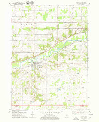
1978 Map of Saranac
USGS Topo · Published 1979About this map
The Grand River carves a central path through Ionia County, defining the valley where the village of Saranac serves as a local hub. In the late 1970s, this area reflects a landscape balancing agriculture and recreation, evidenced by the expansive Ionia State Recreation Area and Brock County Park. The village center is detailed with local landmarks such as Saranac High Sch and the Sewage Disposal Ponds along the riverbank.
Find a feature on this map
56 named features on this map. Tap any name to fly to it.
Don’t see what you’re looking for? This feature index may not catch every label — zoom into the map to look around manually.
Map Details
Editions of this 1978 Saranac Map
This is the sole edition of this map. No revisions or reprints were ever made.
Other maps of this area

1916 · Ionia
USGS Topo · 1:62,500

1918 · Ionia
USGS Topo · 1:62,500

1918 · Lowell
USGS Topo · 1:62,500

1943 · Ionia
USGS Topo · 1:62,500

1943 · Lowell
USGS Topo · 1:62,500

1954 · Midland
USGS Topo · 1:250,000

1958 · Midland
USGS Topo · 1:250,000

1958 · Grand Rapids
USGS Topo · 1:250,000

1959 · Midland
USGS Topo · 1:250,000

1961 · Grand Rapids
USGS Topo · 1:250,000