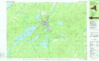
1978 Map of Saranac Lake
USGS Topo · Published 1978About this map
The village of Saranac Lake serves as the central hub of this late-1970s survey, situated where the Saranac River flows into Lake Flower and surrounded by the dense forest of the Adirondack State Park. The map documents a complex mountain landscape defined by major water bodies like Lower Saranac Lake and Oseetah Lake, alongside smaller high-elevation ponds such as Kiwassa Lake and Lake Colby. Cultural features reflect the area's development as a health and educational center, including the Will Rogers Memorial Hospital, the settlement at Trudeau, and North Country Community College. Local infrastructure is visible through landmarks like the Correctional Institution at Ray Brook and the Mt Pisgah Ski Area. This edition also captures the region's topography across the Franklin and Essex County line, documenting the peaks of McKenzie Mtn and Ampersand Mountain.
Find a feature on this map
95 named features on this map. Tap any name to fly to it.
Don’t see what you’re looking for? This feature index may not catch every label — zoom into the map to look around manually.
Map Details
Editions of this 1978 Saranac Lake Map
This is the sole edition of this map. No revisions or reprints were ever made.
Other maps of this area

1895 · Mt. Marcy
USGS Topo · 1:62,500

1896 · Lake Placid
USGS Topo · 1:62,500

1898 · Lake Placid
USGS Topo · 1:62,500

1902 · Mt. Marcy
USGS Topo · 1:62,500

1902 · Saranac
USGS Topo · 1:62,500

1904 · Saranac
USGS Topo · 1:62,500

1904 · Santanoni
USGS Topo · 1:62,500

1904 · Long Lake
USGS Topo · 1:62,500

1905 · Saint Regis
USGS Topo · 1:62,500

1948 · Ogdensburg
USGS Topo · 1:250,000