
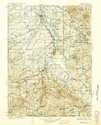
1939 Map of Saratoga
USGS Topo · Published 1939About this map
Saratoga serves as the northern anchor of this high-plateau landscape, where the Saratoga and Encampment Railroad traces the valley south toward the mining and ranching hubs of Riverside and Encampment. The settlement pattern follows the reliable water of the North Platte drainage, with early infrastructure like the Airport at Saratoga and remote outposts such as Hanson Place marking the transition from valley floor to the timbered heights of the Medicine Bow National Forest.
Find a feature on this map
145 named features on this map. Tap any name to fly to it.
Don’t see what you’re looking for? This feature index may not catch every label — zoom into the map to look around manually.
Map Details
Editions of this 1939 Saratoga Map
3 editions found
Other maps of this area

1893 · Fort Steele
USGS Topo · 1:125,000

1906 · Medicine Bow
USGS Topo · 1:125,000

1908 · Medicine Bow
USGS Topo · 1:125,000

1911 · Hahns Peak
USGS Topo · 1:125,000

1913 · Hahns Peak
USGS Topo · 1:125,000

1932 · Savery
USGS Topo · 1:96,000

1940 · Savery
USGS Topo · 1:125,000

1954 · Rawlins
USGS Topo · 1:250,000

1954 · Craig
USGS Topo · 1:250,000

1955 · Davis Peak
USGS Topo · 1:24,000