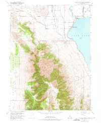
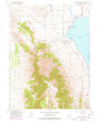
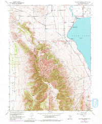
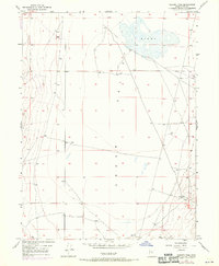
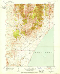
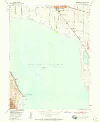
1951 Map of Saratoga Springs
USGS Topo · Published 1975About this map
Utah Lake and the rugged eastern slopes of the Lake Mountains dominate this 1951 survey, revised with 1969 aerial data. The northern shore is marked by the development at Saratoga Springs, where the Jordan River begins its northward flow. Nearby, Hot Springs and the Murdock Pumping Sta indicate the importance of water management in this arid landscape. The map reveals early infrastructure and industry through the Old Railroad Grade in the northwest and several Clay Pits and Prospect locations scattered through the canyons.
Find a feature on this map
33 named features on this map. Tap any name to fly to it.
Don’t see what you’re looking for? This feature index may not catch every label — zoom into the map to look around manually.
Map Details
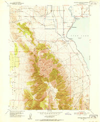
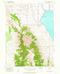
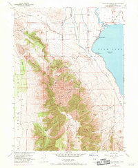
Editions of this 1951 Saratoga Springs Map
6 editions found
Other maps of this area

1885 · Salt Lake
USGS Topo · 1:250,000

1885 · Tooele Valley
USGS Topo · 1:250,000

1915 · Fairfield
USGS Topo · 1:62,500

1917 · Fairfield
USGS Topo · 1:62,500

1947 · Fivemile Pass
USGS Topo · 1:62,500
1947 · Goshen Pass
USGS Topo · 1:24,000

1949 · Goshen Pass
USGS Topo · 1:24,000
1950 · Soldiers Pass
USGS Topo · 1:24,000
1950 · Pelican Point
USGS Topo · 1:24,000
1950 · Lincoln Point
USGS Topo · 1:24,000