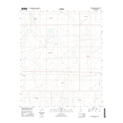
2017 Map of Sardine Mountain
USGS Topo · Published 2017About this map
Sardine Mountain rises above a landscape of high-desert basins and ephemeral water sources in this Chaves County survey. The distribution of family-named ranching outposts such as L E Ranch, Wade Ranch, and Malstrom Ranch illustrates the enduring cattle-rearing economy of the Pecos Valley region. These properties are positioned strategically near drainage features like Long Arroyo Draw and Long Arroyo, where the seasonal collection of water was critical for livestock.
Find a feature on this map
28 named features on this map. Tap any name to fly to it.
Don’t see what you’re looking for? This feature index may not catch every label — zoom into the map to look around manually.
Map Details
Editions of this 2017 Sardine Mountain Map
This is the sole edition of this map. No revisions or reprints were ever made.
Other maps of this area

1949 · Sardine Mountain
USGS Topo · 1:24,000

1949 · Wade Ranch
USGS Topo · 1:24,000

1949 · Malstrom Ranch
USGS Topo · 1:24,000

1949 · L-E Ranch
USGS Topo · 1:24,000

1954 · Brownfield
USGS Topo · 1:250,000

1955 · Roswell
USGS Topo · 1:250,000

1958 · Brownfield
USGS Topo · 1:250,000

1958 · Roswell
USGS Topo · 1:250,000

1962 · Roswell
USGS Topo · 1:250,000

1962 · Brownfield
USGS Topo · 1:250,000