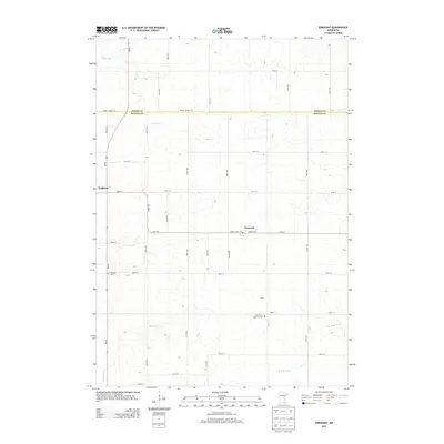
2013 Map of Sargeant
USGS Topo · Published 2013About this map
Waltham and Sargeant anchor this agricultural landscape along the northern border of Mower County in the early 2010s. The terrain is defined by the drainage divide between the Cedar River, which flows south toward the Gulf, and the N Br Root River, part of the Mississippi watershed. This geographic positioning on the divide is reflected in the meandering paths of Roberts Cr and other small headwaters that cut through the rectilinear grid of township roads. Local history is centered on quiet landmarks like the Waltham Cem and Saint John's Lutheran Cem, while the Po in Sargeant remains a focal point for the rural community. The map illustrates the persistent structure of Minnesota's farm country, where the intersection of Dodge Mower RD and various numbered avenues like 600th Ave organizes the productive prairie land.
Find a feature on this map
36 named features on this map. Tap any name to fly to it.
Don’t see what you’re looking for? This feature index may not catch every label — zoom into the map to look around manually.
Map Details
Editions of this 2013 Sargeant Map
This is the sole edition of this map. No revisions or reprints were ever made.
Other maps of this area

1954 · Austin
USGS Topo · 1:62,500

1954 · Mason City
USGS Topo · 1:250,000

1955 · High Forest
USGS Topo · 1:62,500

1957 · Mason City
USGS Topo · 1:250,000

1958 · Mason City
USGS Topo · 1:250,000

1965 · Dexter
USGS Topo · 1:24,000

1966 · Waltham
USGS Topo · 1:24,000

1966 · Hayfield NW
USGS Topo · 1:24,000
1966 · Hayfield
USGS Topo · 1:24,000

1966 · Sargeant
USGS Topo · 1:24,000