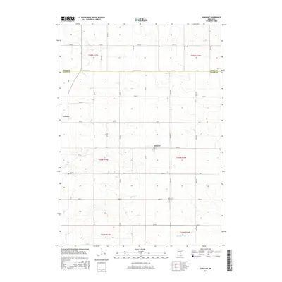
2016 Map of Sargeant
USGS Topo · Published 2016About this map
Agricultural lands along the border of Dodge and Mower counties are defined by a grid of rural roads and the headwaters of several regional waterways. The village of Waltham sits in the western portion of the quadrangle, while Sargeant is located further east along Co Hwy 15. These small communities serve as local hubs in a landscape dominated by township sections and fertile plains. Local history is anchored by sites like Waltham Cem and Saint John's Lutheran Cem, which mark the settlement's early roots.
Find a feature on this map
31 named features on this map. Tap any name to fly to it.
Don’t see what you’re looking for? This feature index may not catch every label — zoom into the map to look around manually.
Map Details
Editions of this 2016 Sargeant Map
This is the sole edition of this map. No revisions or reprints were ever made.
Other maps of this area

1954 · Austin
USGS Topo · 1:62,500

1954 · Mason City
USGS Topo · 1:250,000

1955 · High Forest
USGS Topo · 1:62,500

1957 · Mason City
USGS Topo · 1:250,000

1958 · Mason City
USGS Topo · 1:250,000

1965 · Dexter
USGS Topo · 1:24,000

1966 · Waltham
USGS Topo · 1:24,000

1966 · Hayfield NW
USGS Topo · 1:24,000
1966 · Hayfield
USGS Topo · 1:24,000

1966 · Sargeant
USGS Topo · 1:24,000