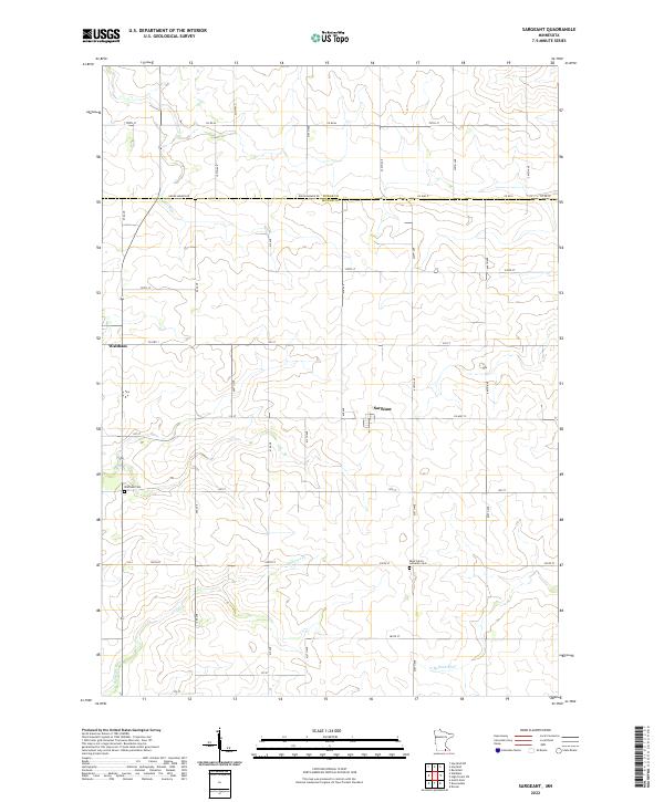
2022 Map of Sargeant
USGS Topo · Published 2022About this map
Sargeant and Waltham sit within a landscape of productive agricultural land and winding prairie waterways near the boundary of Dodge and Mower counties. This modern survey documents a rural environment organized by a rigid grid of county roads and avenues, such as Co Hwy 15 and 600 Ave. The area’s spiritual and community history is marked by the Saint John's Lutheran Cem and Waltham Cem, which serve as primary landmarks for local genealogists. The terrain is defined by the headwaters and branches of several drainage systems, including the southward-flowing Cedar River in the northwest and the N Br Root River in the southeast. These waterways, along with Roberts Cr, illustrate the subtle relief of the southern Minnesota plains and the foundational role of water management in this farming region.
Find a feature on this map
47 named features on this map. Tap any name to fly to it.
Don’t see what you’re looking for? This feature index may not catch every label — zoom into the map to look around manually.
Map Details
Editions of this 2022 Sargeant Map
This is the sole edition of this map. No revisions or reprints were ever made.
Other maps of this area

1954 · Austin
USGS Topo · 1:62,500

1954 · Mason City
USGS Topo · 1:250,000

1955 · High Forest
USGS Topo · 1:62,500

1957 · Mason City
USGS Topo · 1:250,000

1958 · Mason City
USGS Topo · 1:250,000

1965 · Dexter
USGS Topo · 1:24,000

1966 · Waltham
USGS Topo · 1:24,000

1966 · Hayfield NW
USGS Topo · 1:24,000
1966 · Hayfield
USGS Topo · 1:24,000

1966 · Sargeant
USGS Topo · 1:24,000