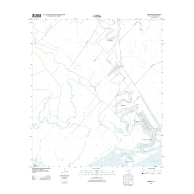
2013 Map of Sargent
USGS Topo · Published 2013About this map
Sargent sits at the heart of a complex coastal drainage system where the meandering Caney Cr meets the tidal influence of East Matagorda Bay. The landscape is defined by the shifting hydrology of the Texas coast, characterized by the dramatic looping turns at Walker Bend, Red Bend, and Carancahua Bend. These natural oxbows and waterway patterns influenced early settlement and navigation, with the Sargent Cem and Caney Creek Marina serving as anchors for the local community near the Gulf of Mexico.
Find a feature on this map
66 named features on this map. Tap any name to fly to it.
Don’t see what you’re looking for? This feature index may not catch every label — zoom into the map to look around manually.
Map Details
Editions of this 2013 Sargent Map
This is the sole edition of this map. No revisions or reprints were ever made.
Other maps of this area

1951 · Bay City
USGS Topo · 1:250,000

1952 · Lake Austin
USGS Topo · 1:24,000

1952 · Cedar Lane NE
USGS Topo · 1:24,000

1952 · Dressing Point
USGS Topo · 1:24,000

1952 · Cedar Lakes West
USGS Topo · 1:24,000
1952 · Brown Cedar Cut
USGS Topo · 1:24,000

1952 · Bay City NE
USGS Topo · 1:24,000

1952 · Cedar Lane
USGS Topo · 1:24,000

1952 · Sargent
USGS Topo · 1:24,000

1956 · Bay City
USGS Topo · 1:250,000