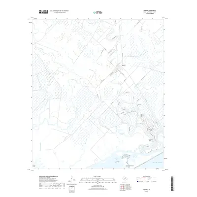
2019 Map of Sargent
USGS Topo · Published 2019About this map
Caney Creek meanders through the coastal lowlands of Matagorda County, shaping the settlement patterns of Sargent and the surrounding bends. This 2019 survey captures the intricate network of tidal bayous and drainage ditches that define the landscape as it approaches the Gulf of Mexico. The area is characterized by residential development following the natural curves of the water, particularly at Walker Bend and Red Bend, while the Sargent Cem remains a central point for local genealogical interest.
Find a feature on this map
64 named features on this map. Tap any name to fly to it.
Don’t see what you’re looking for? This feature index may not catch every label — zoom into the map to look around manually.
Map Details
Editions of this 2019 Sargent Map
This is the sole edition of this map. No revisions or reprints were ever made.
Other maps of this area

1951 · Bay City
USGS Topo · 1:250,000

1952 · Lake Austin
USGS Topo · 1:24,000

1952 · Cedar Lane NE
USGS Topo · 1:24,000

1952 · Dressing Point
USGS Topo · 1:24,000

1952 · Cedar Lakes West
USGS Topo · 1:24,000
1952 · Brown Cedar Cut
USGS Topo · 1:24,000

1952 · Bay City NE
USGS Topo · 1:24,000

1952 · Cedar Lane
USGS Topo · 1:24,000

1952 · Sargent
USGS Topo · 1:24,000

1956 · Bay City
USGS Topo · 1:250,000