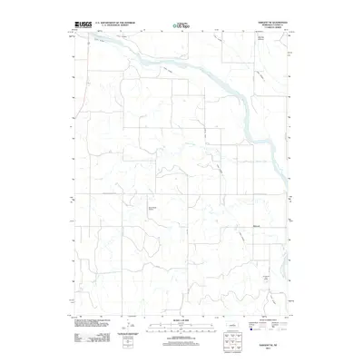
2011 Map of Sargent SE
USGS Topo · Published 2011About this map
The Dowse Sod House stands as a significant landmark in this section of Custer County, representing the architectural heritage of the Nebraska plains. Situated near the banks of the Middle Loup River, the landscape is defined by an extensive irrigation network, including Canal Number 1 and Canal Number 2, which divert water to support the agricultural operations of the region. The small settlement of Wescott sits east of Wagner Creek, a waterway that meanders through the central and western portions of the quadrangle before joining the river. Local transportation and logistics are anchored by the Hyde Ranch Airport and a grid of rural routes such as Ord Rd and Comstock Rd, while the terrain breaks into the distinct Big Oak Canyon in the northeast corner.
Find a feature on this map
15 named features on this map. Tap any name to fly to it.
Don’t see what you’re looking for? This feature index may not catch every label — zoom into the map to look around manually.
Map Details
Editions of this 2011 Sargent SE Map
This is the sole edition of this map. No revisions or reprints were ever made.
Other maps of this area

1951 · Westerville
USGS Topo · 1:24,000

1951 · Ansley NE
USGS Topo · 1:24,000

1951 · Arcadia West
USGS Topo · 1:24,000

1952 · Sargent East
USGS Topo · 1:24,000

1952 · Sargent SE
USGS Topo · 1:24,000

1952 · Sargent West
USGS Topo · 1:24,000

1952 · Comstock
USGS Topo · 1:24,000

1952 · Sargent SW
USGS Topo · 1:24,000

1952 · Comstock NW
USGS Topo · 1:24,000

1955 · Broken Bow
USGS Topo · 1:250,000