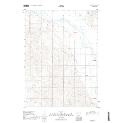
2017 Map of Sargent SE
USGS Topo · Published 2017About this map
The Middle Loup River winds through the eastern portion of this Custer County landscape, defining the character of the river valley near the community of Comstock. This 2017 survey reflects the persistent agricultural footprint of the region, where Canal Number 1 and Canal Number 2 demonstrate the managed water systems crucial for local farming. To the south, the settlement of Wescott sits near the intersection of Wescott Rd and Rd 458, while the Douglas Grove Cem provides a focal point for local genealogical research. The terrain shifts from the level river bottoms into the rising elevations of Big Oak Canyon in the northeast, with a grid of rural routes like Oak Grove Rd and Round Valley Rd connecting scattered farmsteads across the township lines of T19N and T18N.
Find a feature on this map
28 named features on this map. Tap any name to fly to it.
Don’t see what you’re looking for? This feature index may not catch every label — zoom into the map to look around manually.
Map Details
Editions of this 2017 Sargent SE Map
This is the sole edition of this map. No revisions or reprints were ever made.
Other maps of this area

1951 · Westerville
USGS Topo · 1:24,000

1951 · Ansley NE
USGS Topo · 1:24,000

1951 · Arcadia West
USGS Topo · 1:24,000

1952 · Sargent East
USGS Topo · 1:24,000

1952 · Sargent SE
USGS Topo · 1:24,000

1952 · Sargent West
USGS Topo · 1:24,000

1952 · Comstock
USGS Topo · 1:24,000

1952 · Sargent SW
USGS Topo · 1:24,000

1952 · Comstock NW
USGS Topo · 1:24,000

1955 · Broken Bow
USGS Topo · 1:250,000