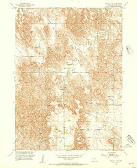
1952 Map of Sargent SW
USGS Topo · Published 1954About this map
Antelope Valley and Somerford Valley slice through the elevated plains of Custer County, defining a landscape of traditional Nebraska agricultural townships. The map documents a rural infrastructure in transition during the early 1950s, recording several local schoolhouses that served these dispersed farming communities. While the Somerford Sch, Coburg Sch, and Elton Sch remained landmarks of their respective districts, the Antelope Sch (Abandoned) serves as a marker of the shifting population and consolidation common in the post-war era. Across Lillian, Douglas Grove, and Garfield townships, the placement of windmills and the orientation of drainages like Wagner Creek and Boggs illustrate the vital relationship between the topography of the Table and the water sources required for homesteading in this part of the Missouri River Basin.
Find a feature on this map
17 named features on this map. Tap any name to fly to it.
Don’t see what you’re looking for? This feature index may not catch every label — zoom into the map to look around manually.
Map Details
Editions of this 1952 Sargent SW Map
3 editions found
Other maps of this area

1951 · Broken Bow NE
USGS Topo · 1:24,000

1951 · Westerville
USGS Topo · 1:24,000

1951 · Ansley NE
USGS Topo · 1:24,000

1951 · Walworth
USGS Topo · 1:24,000

1951 · Round Valley
USGS Topo · 1:24,000

1952 · Sargent East
USGS Topo · 1:24,000

1952 · Sargent SE
USGS Topo · 1:24,000

1952 · Sargent West
USGS Topo · 1:24,000

1952 · Sargent SW
USGS Topo · 1:24,000

1955 · Broken Bow
USGS Topo · 1:250,000