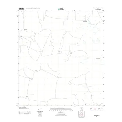
2013 Map of Sarita SW
USGS Topo · Published 2013About this map
Scattered windmills across the South Texas ranchlands define the water-driven geography of this Kenedy County landscape. In this arid coastal plain, named wells like Honeymoon Windmill and La Bareda Windmill represent the vital infrastructure required for cattle operations and survival. The land is partitioned by ranch roads and fence lines that connect points such as Quick Windmill and Disputas Windmill, tracing a network of land management where water sources are the primary landmarks. Many of these names, including La Novia Windmill and Guajalote Windmill, reflect the deep cultural heritage and Spanish-language history of the South Texas brush country. This mapping of the early 21st century documents the continued reliance on these specific watering points, which have served as the focal points for local navigation and ranching genealogy for generations.
Find a feature on this map
17 named features on this map. Tap any name to fly to it.
Don’t see what you’re looking for? This feature index may not catch every label — zoom into the map to look around manually.
Map Details
Editions of this 2013 Sarita SW Map
This is the sole edition of this map. No revisions or reprints were ever made.
Other maps of this area

1921 · Falfurrias
USGS Topo · 1:125,000

1923 · Armstrong
USGS Topo · 1:62,500

1928 · Sarita
USGS Topo · 1:125,000

1949 · Mc Allen
USGS Topo · 1:250,000

1950 · Corpus Christi
USGS Topo · 1:250,000

1953 · Brownsville
USGS Topo · 1:250,000

1954 · McAllen
USGS Topo · 1:250,000

1954 · Sarita
USGS Topo · 1:62,500

1956 · Corpus Christi
USGS Topo · 1:250,000

1956 · Pita Camp
USGS Topo · 1:24,000