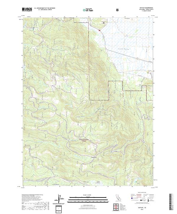
2021 Map of Sattley
USGS Topo · Published 2021About this map
Sierra Valley dominates the northeastern landscape of this region, providing a stark contrast to the high-elevation terrain of the Tahoe National Forest to the south and west. The map documents a complex network of historic routes and modern forest roads, including the notable Henness Pass Rd and Yuba Pass Rd. These corridors reflect a long history of transit through the Sierra Nevada, connecting landmarks like Yuba Pass and Henness Pass with surrounding meadows. Small pockets of local history are preserved at the Sattley Cem and Sierraville Cem, while the rugged interior is defined by steep drainages such as Wild Bill Canyon and Dark Canyon. Water resources are abundant, from the headwaters of the Yuba River to isolated alpine features like Coburn Lake and Lake of the Woods. The geography transitions from the open flats of the valley floor near Randolph Hill to the sheltered basins of French Meadow and Coppins Meadow.
Find a feature on this map
53 named features on this map. Tap any name to fly to it.
Don’t see what you’re looking for? This feature index may not catch every label — zoom into the map to look around manually.
Map Details
Editions of this 2021 Sattley Map
This is the sole edition of this map. No revisions or reprints were ever made.
Other maps of this area

1890 · Sierraville
USGS Topo · 1:125,000

1891 · Downieville
USGS Topo · 1:125,000

1891 · Colfax
USGS Topo · 1:125,000

1891 · Truckee
USGS Topo · 1:125,000

1892 · Sierraville
USGS Topo · 1:125,000

1892 · Colfax
USGS Topo · 1:125,000

1893 · Truckee
USGS Topo · 1:125,000

1893 · Downieville
USGS Topo · 1:125,000

1894 · Colfax
USGS Topo · 1:125,000

1894 · Sierraville
USGS Topo · 1:125,000