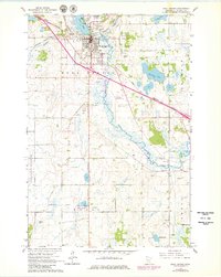
1965 Map of Sauk Centre
USGS Topo · Published 1980About this map
The city of Sauk Centre serves as the focal point of this central Minnesota landscape, where the Sauk River flows south from Sauk Lake. This mid-century survey illustrates the town's growth as a regional hub, featuring the State School for Girls and the local High School. The influence of the Great Northern railroad is evident in the industrial and transit patterns, alongside the Sauk Centre Municipal Airport and a Drive-in Theater. Rural life is marked by numerous family and community landmarks, including Bohemian Cem, Greenwood Cem, and St Pauls Cem. Conservation areas such as the National Waterfowl Production Area and State Wildlife Management Area flank the river, while several Gravel Pits indicate local natural resource extraction during this era.
Find a feature on this map
32 named features on this map. Tap any name to fly to it.
Don’t see what you’re looking for? This feature index may not catch every label — zoom into the map to look around manually.
Map Details
Editions of this 1965 Sauk Centre Map
2 editions found
Other maps of this area

1953 · Saint Cloud
USGS Topo · 1:250,000

1957 · Saint Cloud
USGS Topo · 1:250,000

1958 · Saint Cloud
USGS Topo · 1:250,000

1965 · Greenwald
USGS Topo · 1:24,000

1965 · Sauk Centre
USGS Topo · 1:24,000

1965 · Melrose
USGS Topo · 1:24,000

1965 · Padua
USGS Topo · 1:24,000

1965 · Raymond Lake
USGS Topo · 1:24,000

1965 · Elrosa
USGS Topo · 1:24,000

1966 · West Union
USGS Topo · 1:24,000