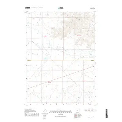
2017 Map of Savage Peak
USGS Topo · Published 2017About this map
The Oregon Trl cuts across this high-desert landscape, following the corridor of the Sweetwater River as it winds through central Wyoming. This 2017 survey details the complex topography where the river meanders through wide valleys before the land rises sharply toward the granite heights of Savage Peak and the tucked-away basin of Savage Pocket. The intersection of the Natrona Co and Carbon Co line divides the terrain, which is defined by a network of seasonal drainages and early water management features.
Find a feature on this map
19 named features on this map. Tap any name to fly to it.
Don’t see what you’re looking for? This feature index may not catch every label — zoom into the map to look around manually.
Map Details
Editions of this 2017 Savage Peak Map
This is the sole edition of this map. No revisions or reprints were ever made.
Other maps of this area

1951 · Savage Peak
USGS Topo · 1:24,000

1951 · Bucklin Reservoirs
USGS Topo · 1:24,000

1951 · Independence Rock
USGS Topo · 1:24,000

1951 · Lone Mountain
USGS Topo · 1:24,000

1953 · Spanish Mine
USGS Topo · 1:24,000

1955 · Casper
USGS Topo · 1:250,000

1958 · Casper
USGS Topo · 1:250,000

1959 · Miller Spring
USGS Topo · 1:24,000
1959 · Beulah Belle Lake
USGS Topo · 1:24,000

1962 · Casper
USGS Topo · 1:250,000