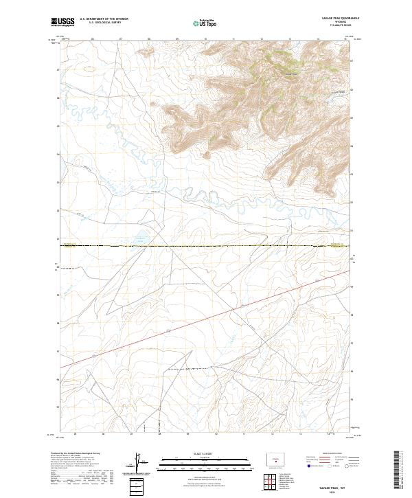
2021 Map of Savage Peak
USGS Topo · Published 2021About this map
The Sweetwater River winds through this high-altitude landscape on the border of Natrona and Carbon counties. The river valley, historically significant as a natural corridor through the western mountains, is marked here by the path of the Oregon Trl, which parallels the watercourse. To the northeast, the terrain rises sharply toward the prominence of Savage Peak and the nearby Savage Pocket. Irrigation and water management are evident in the presence of the Turkey Track Ditch and Jackson Lake. Several small seasonal drainages, including Whiskey Cr and Cherry Cr, feed into the river system from the surrounding uplands, illustrating the hydrologic network of this grazing and ranching country.
Find a feature on this map
18 named features on this map. Tap any name to fly to it.
Don’t see what you’re looking for? This feature index may not catch every label — zoom into the map to look around manually.
Map Details
Editions of this 2021 Savage Peak Map
This is the sole edition of this map. No revisions or reprints were ever made.
Other maps of this area

1951 · Savage Peak
USGS Topo · 1:24,000

1951 · Bucklin Reservoirs
USGS Topo · 1:24,000

1951 · Independence Rock
USGS Topo · 1:24,000

1951 · Lone Mountain
USGS Topo · 1:24,000

1953 · Spanish Mine
USGS Topo · 1:24,000

1955 · Casper
USGS Topo · 1:250,000

1958 · Casper
USGS Topo · 1:250,000

1959 · Miller Spring
USGS Topo · 1:24,000
1959 · Beulah Belle Lake
USGS Topo · 1:24,000

1962 · Casper
USGS Topo · 1:250,000