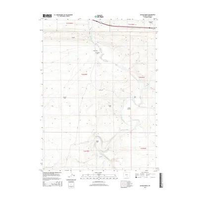
2015 Map of Savage Ranch
USGS Topo · Published 2015About this map
The North Platte River defines the central corridor of this Carbon County landscape, carving a meandering path through the high desert terrain. Its most prominent hydrological feature is the sharp turn at Oxbow Bend, where the river creates a wide loop near the southern edge of the survey. North of this bend, the water flows through the expansive Savage Meadows, an area of lower elevation flanked by the Savage Hills to the west. The ranching heritage of the region is centered on the Savage Ranch, while the surrounding topography is marked by distinctive formations like the Hogback and the open stretches of Severson Flats. Local infrastructure is represented by CR 347 and CR 345, which provide access through the complex network of draws and canyons, including Hugus Draw and Whitehorse Canyon, illustrating the modern management of this rural Wyoming territory.
Find a feature on this map
22 named features on this map. Tap any name to fly to it.
Don’t see what you’re looking for? This feature index may not catch every label — zoom into the map to look around manually.
Map Details
Editions of this 2015 Savage Ranch Map
This is the sole edition of this map. No revisions or reprints were ever made.
Other maps of this area

1893 · Fort Steele
USGS Topo · 1:125,000

1914 · Walcott
USGS Topo · 1:62,500

1953 · Sinclair
USGS Topo · 1:24,000

1954 · Rawlins
USGS Topo · 1:250,000

1955 · Overland
USGS Topo · 1:24,000

1955 · Overland Crossing
USGS Topo · 1:24,000

1955 · Meads
USGS Topo · 1:24,000

1955 · Savage Ranch
USGS Topo · 1:24,000

1956 · Bolten Ranch
USGS Topo · 1:62,500

1958 · Rawlins
USGS Topo · 1:250,000