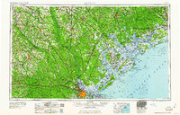
1961 Map of Savannah
USGS Topo · Published 1961About this map
The Savannah River and its intricate coastal estuary anchor this mid-century survey of the Lowcountry, capturing a landscape defined by expansive tidal marshes and significant military footprints. Inland from the coast, the vast Fort Stewart Military Reservation and the Savannah National Wildlife Refuge represent large-scale land use changes that preserved territory as urban centers like Savannah and Beaufort expanded. The mapping details the complex waterway systems of the Broad River, Coosaw River, and Ogeechee River, alongside a thriving rail network featuring the Seaboard Air Line RR and the Atlantic Coast Line RR.
Find a feature on this map
132 named features on this map. Tap any name to fly to it.
Don’t see what you’re looking for? This feature index may not catch every label — zoom into the map to look around manually.
Map Details
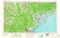
Editions of this 1961 Savannah Map
2 editions found
Other maps of this area

1918 · Walterboro
USGS Topo · 1:62,500

1918 · Kiawah Island
USGS Topo · 1:21,120

1918 · Hinesville
USGS Topo · 1:62,500

1918 · Green Pond
USGS Topo · 1:62,500

1918 · Varnville
USGS Topo · 1:62,500

1918 · Yemassee
USGS Topo · 1:62,500

1918 · Cottageville
USGS Topo · 1:62,500

1918 · Oliver
USGS Topo · 1:62,500

1919 · Ladson
USGS Topo · 1:21,120

1919 · Johns Island
USGS Topo · 1:21,120