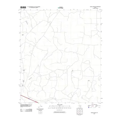
2010 Map of Savell Ranch
USGS Topo · Published 2010About this map
Savell Ranch and Simmons Ranch define the sparsely populated landscape of Sutton County in this early twenty-first-century survey. The terrain is characterized by a network of seasonal drainage features, including the prominent Buckhorn Draw and Burns Draw, which carve through the land and dictate the placement of ranching infrastructure. These intermittent watercourses, such as Turkey Roost Draw and Granger Draw, provide critical insights into the hydrology and land use patterns of the region. Transportation across this isolated area is facilitated primarily by Ranch Rd 2129, which serves as a primary artery connecting the dispersed operations like the R Mayer Ranch. This map offers a clear look at the enduring ranching tradition and the physical geography of the Edwards Plateau region, where wide-open spaces and topographic relief are shaped by these distinct draws.
Find a feature on this map
12 named features on this map. Tap any name to fly to it.
Don’t see what you’re looking for? This feature index may not catch every label — zoom into the map to look around manually.
Map Details
Editions of this 2010 Savell Ranch Map
This is the sole edition of this map. No revisions or reprints were ever made.
Other maps of this area

1954 · Sonora
USGS Topo · 1:250,000

1958 · Sonora
USGS Topo · 1:250,000

1964 · Sonora
USGS Topo · 1:24,000

1964 · Eldorado SW
USGS Topo · 1:24,000

1964 · Sonora NW
USGS Topo · 1:24,000

1964 · Coupe Ranch
USGS Topo · 1:24,000

1964 · Bailey Draw
USGS Topo · 1:24,000

1967 · Nolen Draw
USGS Topo · 1:24,000

1967 · Savell Ranch
USGS Topo · 1:24,000

1967 · Caverns Of Sonora
USGS Topo · 1:24,000