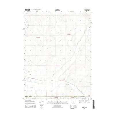
2015 Map of Savery
USGS Topo · Published 2015About this map
The settlement of Savery sits at the southern edge of Carbon County, Wyoming, just north of the Colorado state line where the high desert terrain transitions into the valley of the Little Snake River. This landscape is defined by the convergence of several drainages, most notably Savery Cr and Dutch Joe Cr, which flow through the arid draws and gulches characteristic of the region. The map highlights the early 21st-century infrastructure of this ranching community, including the First Mesa Ditch and local access routes like Browns Hill Rd. Cultural landmarks such as the Reader Cem and Baker Cem offer essential points of interest for genealogists tracking the history of families in this borderland area. To the west, the flat-topped Dolan Mesa and the Dixon Airport break the undulating terrain of Coal Bank Draw and Big Gulch, marking the intersection of traditional land use and modern utility.
Find a feature on this map
27 named features on this map. Tap any name to fly to it.
Don’t see what you’re looking for? This feature index may not catch every label — zoom into the map to look around manually.
Map Details
Editions of this 2015 Savery Map
This is the sole edition of this map. No revisions or reprints were ever made.
Other maps of this area

1916 · Craig
USGS Topo · 1:125,000

1932 · Savery
USGS Topo · 1:96,000

1940 · Savery
USGS Topo · 1:125,000

1954 · Rawlins
USGS Topo · 1:250,000

1954 · Craig
USGS Topo · 1:250,000

1957 · Craig
USGS Topo · 1:250,000

1957 · Baggs
USGS Topo · 1:62,500

1958 · Rawlins
USGS Topo · 1:250,000

1958 · Craig
USGS Topo · 1:250,000

1960 · Craig
USGS Topo · 1:250,000