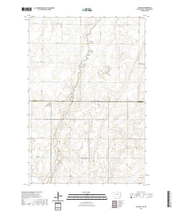
2021 Map of Savo NW
USGS Topo · Published 2021About this map
Maple River meanders southward through this rural landscape on the border of North and South Dakota. The topography is defined by the subtle elevations of the Northern Plains, most notably Cannon Hill situated in the northeast. This 2021 survey shows a highly organized grid of section lines and county roads, such as Co Rd 8 and Co Rd 3, which facilitate access to the surrounding agricultural tracts. The map captures a moment in the modern era where traditional land divisions of the Public Land Survey System—including t129n r62w and t128n r63w—remain the primary framework for land use and property boundaries along the state line.
Find a feature on this map
29 named features on this map. Tap any name to fly to it.
Don’t see what you’re looking for? This feature index may not catch every label — zoom into the map to look around manually.
Map Details
Editions of this 2021 Savo NW Map
This is the sole edition of this map. No revisions or reprints were ever made.
Other maps of this area

1894 · Monango
USGS Topo · 1:62,500

1894 · Ellendale
USGS Topo · 1:62,500

1894 · Savo
USGS Topo · 1:62,500

1894 · Fullerton
USGS Topo · 1:62,500

1895 · Lamoure
USGS Topo · 1:125,000

1896 · Columbia
USGS Topo · 1:125,000

1896 · Edgeley
USGS Topo · 1:125,000

1899 · Ellendale
USGS Topo · 1:125,000

1918 · La Moure
USGS Topo · 1:125,000

1925 · Edgeley
USGS Topo · 1:125,000