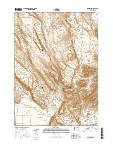
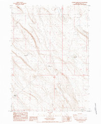
2017 Map of Sawed Horn
USGS Topo · Published 2017About this map
Sawed Horn and Jug Mtn anchor this high-desert landscape in Lake County, characterized by a complex network of seasonal water sources and steep-walled drainages like Shell Rock Canyon. The distribution of features such as Brattain Waterhole Number 10, Forks Waterhole, and Collins Waterhole reveals the critical importance of water management for livestock in this arid environment. Managed water resources are further evidenced by Club Reservoir and Keiso Reservoir, which capture runoff in an area where natural sources like XL Spring are sparse. Transportation is limited to remote routes like Co Rd 2-06, reflecting a late-twentieth-century pattern of land use focused on open-range grazing rather than permanent settlement. Prominent geological markers like Euchre Butte provided essential navigation points for travelers and ranchers navigating the vast Township and Range blocks of the Oregon outback.
Find a feature on this map
15 named features on this map. Tap any name to fly to it.
Don’t see what you’re looking for? This feature index may not catch every label — zoom into the map to look around manually.
Map Details
Editions of this 2017 Sawed Horn Map
This is the sole edition of this map. No revisions or reprints were ever made.
Other maps of this area

1955 · Klamath Falls
USGS Topo · 1:250,000

1958 · Klamath Falls
USGS Topo · 1:250,000

1966 · Coglan Buttes NE
USGS Topo · 1:24,000

1968 · Lake Abert North
USGS Topo · 1:24,000

1968 · Commodore Ridge
USGS Topo · 1:24,000

1974 · Lake Abert
USGS Topo · 1:100,000
1984 · Coleman Hills
USGS Topo · 1:24,000
1984 · Sawed Horn
USGS Topo · 1:24,000
1984 · Alkali Lake
USGS Topo · 1:24,000
1984 · Poverty Basin South
USGS Topo · 1:24,000