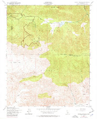
1943 Map of Sawmill Mountain
USGS Topo · Published 1977About this map
Los Padres National Forest straddles the high-elevation boundary of Kern and Ventura counties, anchored by the prominent peak of Mt. Pinos. This 1943 survey, based on 1942 aerial photography, captures a landscape defined by seasonal recreation and resource management. Near Cerro Noroeste, facilities like a Ski Run, Ski Tow, and Swimming Pool indicate the area's development as a mid-century mountain retreat.
Find a feature on this map
25 named features on this map. Tap any name to fly to it.
Don’t see what you’re looking for? This feature index may not catch every label — zoom into the map to look around manually.
Map Details
Editions of this 1943 Sawmill Mountain Map
4 editions found
Other maps of this area

1903 · Mt. Pinos
USGS Topo · 1:125,000

1942 · Eagle Rest Peak
USGS Topo · 1:24,000

1943 · Apache Canyon
USGS Topo · 1:24,000

1943 · San Guillermo
USGS Topo · 1:24,000

1943 · Sawmill Mountain
USGS Topo · 1:24,000

1943 · Santiago Creek
USGS Topo · 1:24,000

1943 · Cuddy Valley
USGS Topo · 1:24,000

1943 · Lockwood Valley
USGS Topo · 1:24,000

1943 · Reyes Peak
USGS Topo · 1:24,000
1944 · San Guillermo
USGS Topo · 1:31,680