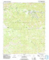
1991 Map of Sawmill Mountain
USGS Topo · Published 1991About this map
Pine Mountain Club serves as the primary residential anchor in this 1991 survey, situated within the high-elevation terrain of the Los Padres National Forest. The landscape is profoundly shaped by the San Andreas Rift Zone, which cuts a distinct path through the topography near the Mil Potrero Highway. This geological feature dictates the alignment of valleys and ridges, including the prominent peaks of Sawmill Mountain and Mount Pinos, where a Condor Observation Site and Radio Tower are positioned to take advantage of the expansive views.
Find a feature on this map
43 named features on this map. Tap any name to fly to it.
Don’t see what you’re looking for? This feature index may not catch every label — zoom into the map to look around manually.
Map Details
Editions of this 1991 Sawmill Mountain Map
2 editions found
Other maps of this area

1903 · Mt. Pinos
USGS Topo · 1:125,000

1942 · Eagle Rest Peak
USGS Topo · 1:24,000

1943 · Apache Canyon
USGS Topo · 1:24,000

1943 · San Guillermo
USGS Topo · 1:24,000

1943 · Sawmill Mountain
USGS Topo · 1:24,000

1943 · Santiago Creek
USGS Topo · 1:24,000

1943 · Cuddy Valley
USGS Topo · 1:24,000

1943 · Lockwood Valley
USGS Topo · 1:24,000

1943 · Reyes Peak
USGS Topo · 1:24,000
1944 · San Guillermo
USGS Topo · 1:31,680