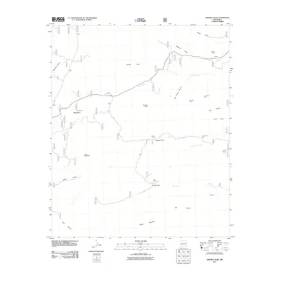
2011 Map of Sawmill Peak
USGS Topo · Published 2011About this map
Webber Shaft and the North Star Mine highlight a landscape defined by small-scale mineral extraction in this section of New Mexico. The map reveals a transition between rugged high-country terrain and localized ranching operations, with family-named locations such as Kline Ranch, Santana Ranch, and Franks Ranch serving as primary landmarks. These sites often appear with corresponding "Place" designations, like Kline Place and Franks Place, suggesting established seasonal or permanent headquarters for cattle operations.
Find a feature on this map
33 named features on this map. Tap any name to fly to it.
Don’t see what you’re looking for? This feature index may not catch every label — zoom into the map to look around manually.
Map Details
Editions of this 2011 Sawmill Peak Map
This is the sole edition of this map. No revisions or reprints were ever made.
Other maps of this area

1949 · Lookout Mountain
USGS Topo · 1:62,500

1954 · Tularosa
USGS Topo · 1:250,000

1958 · Tularosa
USGS Topo · 1:250,000

1965 · Winston
USGS Topo · 1:24,000

1965 · Iron Mountain
USGS Topo · 1:24,000

1965 · Wahoo Peak
USGS Topo · 1:24,000

1979 · Truth or Consequences
USGS Topo · 1:100,000

1979 · San Mateo Mountains
USGS Topo · 1:100,000
1981 · Taylor Peak
USGS Topo · 1:24,000
1981 · Baily Points
USGS Topo · 1:24,000