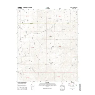
2013 Map of Sawmill Peak
USGS Topo · Published 2013About this map
Franks Ranch and Santana Ranch characterize the isolated ranching landscape of the Gila National Forest in Catron County. This 2013 survey documents the enduring presence of specific homesteads and landmarks like Franks Place and Santana Place, which suggest a long-standing family-oriented land use pattern in this New Mexico interior. The map records essential water infrastructure such as Hardcastle Tank, highlighting the importance of managed water sources for livestock in this high-elevation terrain. Local property history is further reflected in features like Kline Ranch and Kline Place, providing a precise record of rural settlement before more modern shifts in land management.
Find a feature on this map
7 named features on this map. Tap any name to fly to it.
Don’t see what you’re looking for? This feature index may not catch every label — zoom into the map to look around manually.
Map Details
Editions of this 2013 Sawmill Peak Map
This is the sole edition of this map. No revisions or reprints were ever made.
Other maps of this area

1949 · Lookout Mountain
USGS Topo · 1:62,500

1954 · Tularosa
USGS Topo · 1:250,000

1958 · Tularosa
USGS Topo · 1:250,000

1965 · Winston
USGS Topo · 1:24,000

1965 · Iron Mountain
USGS Topo · 1:24,000

1965 · Wahoo Peak
USGS Topo · 1:24,000

1979 · Truth or Consequences
USGS Topo · 1:100,000

1979 · San Mateo Mountains
USGS Topo · 1:100,000
1981 · Taylor Peak
USGS Topo · 1:24,000
1981 · Baily Points
USGS Topo · 1:24,000