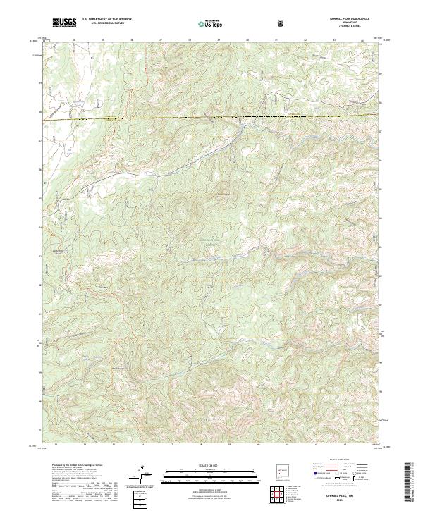
2023 Map of Sawmill Peak
USGS Topo · Published 2023About this map
The Gila National Forest high country in the Black Range is defined by the high elevations of the Continental Divide. This landscape centers on the 8,000-foot summit of Sawmill Peak, where the drainage patterns of the American West split. Water sources are critical in this high-desert environment, marked by sites like Whiskey Spring, Jenny Spring, and Silver Spring, alongside ranching improvements such as Hardcastle Tank. Modern travel through the area follows the Continental Divide National Scenic Trl, which winds past Kline Mtn and Franks Mtn. The topography is deeply incised by numerous drainages including Wildhorse Canyon and Poverty Creek, illustrating the remote and difficult terrain of the Catron and Sierra county line.
Find a feature on this map
37 named features on this map. Tap any name to fly to it.
Don’t see what you’re looking for? This feature index may not catch every label — zoom into the map to look around manually.
Map Details
Editions of this 2023 Sawmill Peak Map
This is the sole edition of this map. No revisions or reprints were ever made.
Other maps of this area

1949 · Lookout Mountain
USGS Topo · 1:62,500

1954 · Tularosa
USGS Topo · 1:250,000

1958 · Tularosa
USGS Topo · 1:250,000

1965 · Winston
USGS Topo · 1:24,000

1965 · Iron Mountain
USGS Topo · 1:24,000

1965 · Wahoo Peak
USGS Topo · 1:24,000

1979 · Truth or Consequences
USGS Topo · 1:100,000

1979 · San Mateo Mountains
USGS Topo · 1:100,000
1981 · Taylor Peak
USGS Topo · 1:24,000
1981 · Baily Points
USGS Topo · 1:24,000