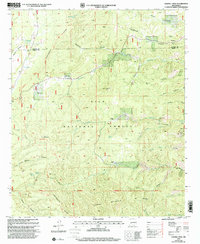
1999 Map of Sawmill Peak
USGS Topo · Published 2002About this map
Gila National Forest encompasses this high-elevation terrain where the Continental Divide National Scenic Trail winds through deep canyons and over prominent summits. The landscape is defined by its mining legacy, with numerous operations concentrated in the eastern portion of the quadrangle. These include the Webber Mine, Fluorine Mine, and the Little Wonder Mine, suggesting a period of significant mineral exploration or extraction.
Find a feature on this map
46 named features on this map. Tap any name to fly to it.
Don’t see what you’re looking for? This feature index may not catch every label — zoom into the map to look around manually.
Map Details
Editions of this 1999 Sawmill Peak Map
This is the sole edition of this map. No revisions or reprints were ever made.
Other maps of this area

1949 · Lookout Mountain
USGS Topo · 1:62,500

1954 · Tularosa
USGS Topo · 1:250,000

1958 · Tularosa
USGS Topo · 1:250,000

1965 · Winston
USGS Topo · 1:24,000

1965 · Iron Mountain
USGS Topo · 1:24,000

1965 · Wahoo Peak
USGS Topo · 1:24,000

1979 · Truth or Consequences
USGS Topo · 1:100,000

1979 · San Mateo Mountains
USGS Topo · 1:100,000
1981 · Taylor Peak
USGS Topo · 1:24,000
1981 · Baily Points
USGS Topo · 1:24,000