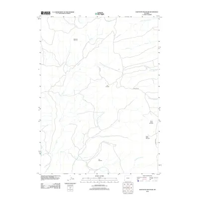
2012 Map of Sawtooth Mountain
USGS Topo · Published 2012About this map
Sawtooth Mountain dominates the northwestern portion of this Uinta County landscape, part of a high-altitude drainage system that feeds several significant watercourses. The terrain is characterized by prominent geologic formations, including the distinct ridge known as The Hogback in the south and the sharp profile of The Pinnacle near the center of the quadrangle. These features guide the paths of local travel routes like Co RD 103 and Carter Creek Rd.
Find a feature on this map
16 named features on this map. Tap any name to fly to it.
Don’t see what you’re looking for? This feature index may not catch every label — zoom into the map to look around manually.
Map Details
Editions of this 2012 Sawtooth Mountain Map
This is the sole edition of this map. No revisions or reprints were ever made.
Other maps of this area

1912 · Randolph
USGS Topo · 1:125,000

1954 · Ogden
USGS Topo · 1:250,000

1958 · Ogden
USGS Topo · 1:250,000

1960 · Ogden
USGS Topo · 1:250,000

1962 · Bell Butte NE
USGS Topo · 1:24,000

1962 · Sawtooth Mountain
USGS Topo · 1:24,000

1962 · Windy Point
USGS Topo · 1:24,000

1962 · Bell Butte
USGS Topo · 1:24,000

1965 · Little Dee Creek
USGS Topo · 1:24,000

1965 · Three Forks
USGS Topo · 1:24,000