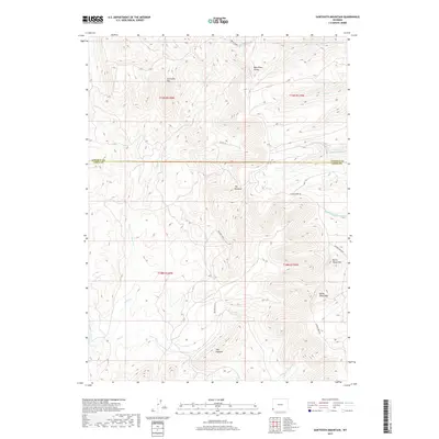
2017 Map of Sawtooth Mountain
USGS Topo · Published 2017About this map
Bear River Divide dominates this high-altitude landscape on the border of Lincoln and Uinta Counties, serving as a primary hydrologic separator for the region's complex drainage systems. To the west, the headwaters of Alkali Cr and Salt Cr carve through the terrain, while the eastern slopes feed into Carter Cr and the various forks of N Fork Sheep Cr. The topography is defined by sharp, named ridges and summits including Sawtooth Mtn, The Pinnacle, and the distinctive spine of The Hogback. The 2017 survey reveals a sparse network of access roads such as Co Rd 103 and Carter Creek Rd, alongside the remote airstrip at Whitney Field, illustrating the area's continued use for ranching and resource management in the early 21st century.
Find a feature on this map
23 named features on this map. Tap any name to fly to it.
Don’t see what you’re looking for? This feature index may not catch every label — zoom into the map to look around manually.
Map Details
Editions of this 2017 Sawtooth Mountain Map
This is the sole edition of this map. No revisions or reprints were ever made.
Other maps of this area

1912 · Randolph
USGS Topo · 1:125,000

1954 · Ogden
USGS Topo · 1:250,000

1958 · Ogden
USGS Topo · 1:250,000

1960 · Ogden
USGS Topo · 1:250,000

1962 · Bell Butte NE
USGS Topo · 1:24,000

1962 · Sawtooth Mountain
USGS Topo · 1:24,000

1962 · Windy Point
USGS Topo · 1:24,000

1962 · Bell Butte
USGS Topo · 1:24,000

1965 · Little Dee Creek
USGS Topo · 1:24,000

1965 · Three Forks
USGS Topo · 1:24,000