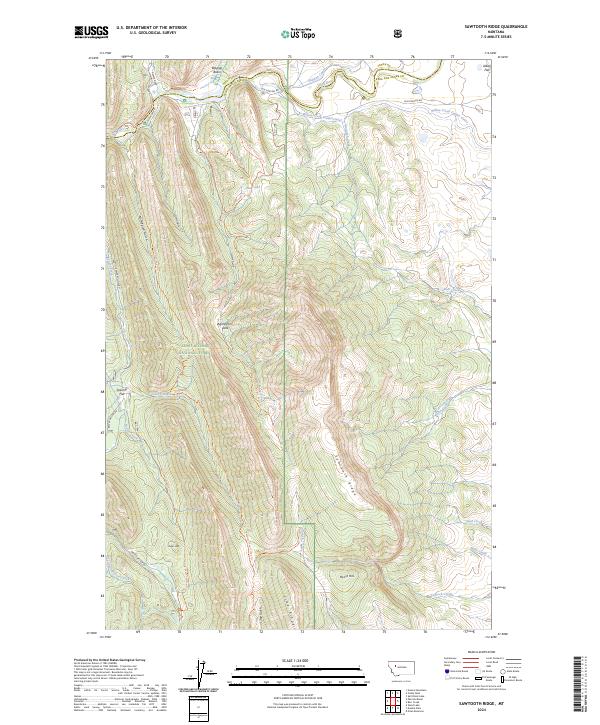
2024 Map of Sawtooth Ridge
USGS Topo · Published 2024About this map
The Lewis & Clark National Forest encompasses this landscape where high-altitude ridges meet an intricate network of water management infrastructure. The Sun River flows across the northern reaches, feeding into the Pishkun Canal and the Willow Creek Feeder Canal. This irrigation system highlights the engineering required to move water through the complex topography of the Front.
Find a feature on this map
40 named features on this map. Tap any name to fly to it.
Don’t see what you’re looking for? This feature index may not catch every label — zoom into the map to look around manually.
Map Details
Editions of this 2024 Sawtooth Ridge Map
This is the sole edition of this map. No revisions or reprints were ever made.
Other maps of this area

1903 · Saypo
USGS Topo · 1:125,000

1903 · Coopers Lake
USGS Topo · 1:125,000

1955 · Choteau
USGS Topo · 1:250,000

1957 · Choteau
USGS Topo · 1:250,000

1958 · Choteau
USGS Topo · 1:250,000

1958 · Barr Creek
USGS Topo · 1:24,000

1958 · Sawtooth Ridge
USGS Topo · 1:24,000

1958 · Patricks Basin
USGS Topo · 1:24,000

1958 · Castle Reef
USGS Topo · 1:24,000
1958 · Split Rock Lake
USGS Topo · 1:24,000