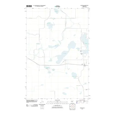
2010 Map of Sawyer
USGS Topo · Published 2010About this map
The town of Sawyer serves as the focal point for this Carlton County landscape, where the intersection of local infrastructure and historic community landmarks is clearly defined. The area is characterized by a high density of water bodies, including Rice Portage Lake, Perch Lake, and Jaskari Lake, which are interconnected by a network of local and township roads. Significant cultural sites are preserved here, notably the Methodist Indian Cemetery and the Big Lake Indian Catholic Cemetery near the shores of Big Lake, highlighting the region's indigenous heritage and established religious centers.
Find a feature on this map
36 named features on this map. Tap any name to fly to it.
Don’t see what you’re looking for? This feature index may not catch every label — zoom into the map to look around manually.
Map Details
Editions of this 2010 Sawyer Map
This is the sole edition of this map. No revisions or reprints were ever made.
Other maps of this area

1953 · Brookston
USGS Topo · 1:24,000

1953 · Duluth
USGS Topo · 1:250,000

1954 · Atkinson
USGS Topo · 1:24,000

1954 · Iverson
USGS Topo · 1:24,000

1954 · Sawyer
USGS Topo · 1:24,000

1954 · Martin Lake
USGS Topo · 1:24,000

1956 · Barnum
USGS Topo · 1:62,500

1958 · Duluth
USGS Topo · 1:250,000

1961 · Cromwell
USGS Topo · 1:62,500

1963 · Gowan
USGS Topo · 1:24,000