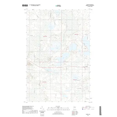
2019 Map of Sawyer
USGS Topo · Published 2019About this map
The settlement of Sawyer serves as the focal point for this landscape in southern Carlton County, characterized by a complex network of wetlands and small glacial lakes. To the north and west, significant water bodies like Miller Lake, Rice Portage Lake, and the uniquely named Dead Fish Lake define the terrain. These lakes are interconnected by a system of drainage features, including Annamahasung Cr and Stoney Brook, alongside man-made improvements such as Ditchbank Rd and Co Ditch No 2. Local history and genealogy interest is concentrated near the town site, where the Sawyer Cem and a Po are located. Further south, named agricultural and residential landmarks like David Creek Farm appear among the woods and marshes. The map details a transition from forest roads like Arrowhead Forest Rd to established county routes, illustrating the modern rural layout of this lake-dotted region.
Find a feature on this map
48 named features on this map. Tap any name to fly to it.
Don’t see what you’re looking for? This feature index may not catch every label — zoom into the map to look around manually.
Map Details
Editions of this 2019 Sawyer Map
This is the sole edition of this map. No revisions or reprints were ever made.
Other maps of this area

1953 · Brookston
USGS Topo · 1:24,000

1953 · Duluth
USGS Topo · 1:250,000

1954 · Atkinson
USGS Topo · 1:24,000

1954 · Iverson
USGS Topo · 1:24,000

1954 · Sawyer
USGS Topo · 1:24,000

1954 · Martin Lake
USGS Topo · 1:24,000

1956 · Barnum
USGS Topo · 1:62,500

1958 · Duluth
USGS Topo · 1:250,000

1961 · Cromwell
USGS Topo · 1:62,500

1963 · Gowan
USGS Topo · 1:24,000