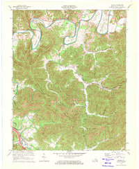
1970 Map of Saxton
USGS Topo · Published 1972About this map
The Cumberland River carves a dramatic path through the northern reaches of this Whitley County landscape, forming deep loops at Horseshoe Bend, Maiden Bend, and Boyd Bend. This 1970 revision reveals a rugged coal-mining economy, where numerous Strip Mines are cut into the slopes of Bowling Mountain and Patterson Mountain. Small mining communities and railroad hamlets are concentrated along the narrow valley floors, connected by the Louisville and Nashville line.
Find a feature on this map
53 named features on this map. Tap any name to fly to it.
Don’t see what you’re looking for? This feature index may not catch every label — zoom into the map to look around manually.
Map Details
Editions of this 1970 Saxton Map
2 editions found
Other maps of this area

1886 · Cumberland Gap
USGS Topo · 1:125,000

1888 · Cumberland Gap
USGS Topo · 1:125,000

1890 · Williamsburg
USGS Topo · 1:125,000

1891 · Cumberland Gap
USGS Topo · 1:125,000

1894 · Williamsburg
USGS Topo · 1:125,000

1952 · Wofford
USGS Topo · 1:24,000

1952 · Barbourville
USGS Topo · 1:24,000

1952 · Saxton
USGS Topo · 1:24,000

1952 · Rockholds
USGS Topo · 1:24,000

1952 · Williamsburg
USGS Topo · 1:24,000