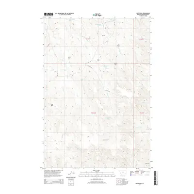
2014 Map of Sayle Hall
USGS Topo · Published 2014About this map
Sayle Hall serves as a central landmark in this drainage-rich portion of Powder River County. The landscape is defined by its complex network of named draws and buttes, including Wallop Butte and Gobbler Knob, which rise above a series of significant creeks. The water system is particularly dense, with Otter Cr, Pasture Cr, and Bradshaw Cr carving through the terrain. Evidence of the region's agricultural infrastructure is found along Bales Road B and Bliss Ranch Rd, which connect the scattered points of activity in this rangeland. Several numbered springs, such as 08S46E23ACCC01 Spring and 09S46E04BCAC01 Spring, indicate critical water sources for the cattle operations that historically and modernly define this corner of Montana.
Find a feature on this map
34 named features on this map. Tap any name to fly to it.
Don’t see what you’re looking for? This feature index may not catch every label — zoom into the map to look around manually.
Map Details
Editions of this 2014 Sayle Hall Map
This is the sole edition of this map. No revisions or reprints were ever made.
Other maps of this area

1954 · Hardin
USGS Topo · 1:250,000

1954 · Ekalaka
USGS Topo · 1:250,000

1954 · Gillette
USGS Topo · 1:250,000

1955 · Sheridan
USGS Topo · 1:250,000

1955 · Gillette
USGS Topo · 1:250,000

1956 · Ekalaka
USGS Topo · 1:250,000

1957 · Hardin
USGS Topo · 1:250,000

1958 · Gillette
USGS Topo · 1:250,000

1958 · Ekalaka
USGS Topo · 1:250,000

1958 · Hardin
USGS Topo · 1:250,000