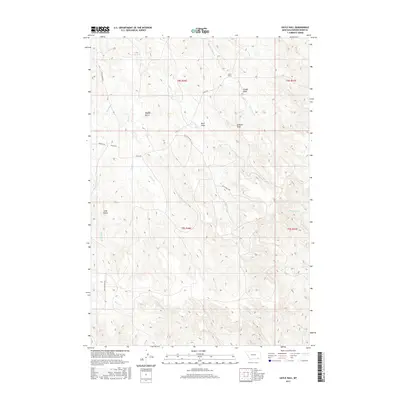
2017 Map of Sayle Hall
USGS Topo · Published 2017About this map
Sayle Hall and the high buttes of the Powder River Basin define this corner of Montana, where the drainages of Otter Cr and Bradshaw Cr cut through the high plains. This landscape reflects the ranching and agricultural patterns of the early twenty-first century, with many secondary routes like Bliss Ranch Rd and Quietus Rd providing access to isolated draws and ridges. Named topographical features such as Wallop Butte, Gobbler Knob, and Long Butte serve as critical landmarks for local navigation and property boundaries in this open country. The intricate network of seasonal streams, including Cedar Cr and Boxelder Cr, illustrates the hydrological dependency of the region's livestock economy on these small, vital watercourses.
Find a feature on this map
27 named features on this map. Tap any name to fly to it.
Don’t see what you’re looking for? This feature index may not catch every label — zoom into the map to look around manually.
Map Details
Editions of this 2017 Sayle Hall Map
This is the sole edition of this map. No revisions or reprints were ever made.
Other maps of this area

1954 · Hardin
USGS Topo · 1:250,000

1954 · Ekalaka
USGS Topo · 1:250,000

1954 · Gillette
USGS Topo · 1:250,000

1955 · Sheridan
USGS Topo · 1:250,000

1955 · Gillette
USGS Topo · 1:250,000

1956 · Ekalaka
USGS Topo · 1:250,000

1957 · Hardin
USGS Topo · 1:250,000

1958 · Gillette
USGS Topo · 1:250,000

1958 · Ekalaka
USGS Topo · 1:250,000

1958 · Hardin
USGS Topo · 1:250,000