
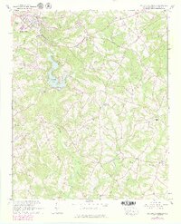
1964 Map of Saylors Crossroads
USGS Topo · Published 1965About this map
The Rocky River and its tributary system define the landscape of south-central Anderson County in the early 1960s, anchored by the recreational and residential hub of Broadway Lake. Near the lake, communities like Belhaven and Bolt are situated along the Southern railroad line, while the southern reaches of the quadrangle are characterized by a network of rural churches and family-named landmarks. The map documents a deeply rooted rural society, where religious and educational life centered on places like New Mount Pleasant Ch, Mount Bethel Ch, and the Wright Sch.
Find a feature on this map
42 named features on this map. Tap any name to fly to it.
Don’t see what you’re looking for? This feature index may not catch every label — zoom into the map to look around manually.
Map Details
Editions of this 1964 Saylors Crossroads Map
2 editions found
Other maps of this area

1888 · Pickens
USGS Topo · 1:125,000

1892 · Abbeville
USGS Topo · 1:125,000

1893 · Elberton
USGS Topo · 1:125,000

1894 · Pickens
USGS Topo · 1:125,000

1954 · Greenville
USGS Topo · 1:250,000

1957 · Anderson
USGS Topo · 1:62,500

1957 · Williamston
USGS Topo · 1:62,500

1958 · Greenville
USGS Topo · 1:250,000

1964 · Iva
USGS Topo · 1:24,000

1964 · Antreville
USGS Topo · 1:24,000