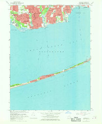
1967 Map of Sayville
USGS Topo · Published 1968About this map
Fire Island stretches across the southern reach of this 1960s survey, separating the Atlantic Ocean from the quiet waters of Great South Bay. The barrier beach is dotted with established summer communities such as Point o' Woods, Cherry Grove, and Fire Island Pines, while the Fire Island National Seashore preserves the unique Sunken Forest. On the mainland, the South Shore villages of Sayville, West Sayville, and Bayport are well-defined by their residential grids and waterfront proximity.
Find a feature on this map
51 named features on this map. Tap any name to fly to it.
Don’t see what you’re looking for? This feature index may not catch every label — zoom into the map to look around manually.
Map Details
Editions of this 1967 Sayville Map
2 editions found
Other maps of this area

1902 · Setauket
USGS Topo · 1:62,500

1902 · Fire Island
USGS Topo · 1:62,500

1903 · Fire Island
USGS Topo · 1:62,500

1904 · Setauket
USGS Topo · 1:62,500

1904 · Islip
USGS Topo · 1:125,000

1904 · Moriches
USGS Topo · 1:62,500

1919 · Setauket
USGS Topo · 1:62,500

1942 · Islip
USGS Topo · 1:125,000

1944 · Bay Shore East
USGS Topo · 1:24,000

1947 · Bellport
USGS Topo · 1:24,000