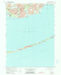
1967 Map of Sayville
USGS Topo · Published 1991About this map
Great South Bay dominates the center of this coastal survey, separating the mainland South Shore from the narrow ribbon of Fire Island. On the northern shore, the bustling suburban growth of the late 1960s is evident in settlements like Sayville, Bayport, and Blue Point, where the Long Island Railroad parallels the Montauk Highway. Notable institutions of the era include the La Salle Military Academy and Sayville High Sch.
Find a feature on this map
53 named features on this map. Tap any name to fly to it.
Don’t see what you’re looking for? This feature index may not catch every label — zoom into the map to look around manually.
Map Details
Editions of this 1967 Sayville Map
2 editions found
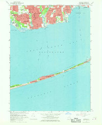
Other maps of this area

1902 · Setauket
USGS Topo · 1:62,500

1902 · Fire Island
USGS Topo · 1:62,500

1903 · Fire Island
USGS Topo · 1:62,500

1904 · Setauket
USGS Topo · 1:62,500

1904 · Islip
USGS Topo · 1:125,000

1904 · Moriches
USGS Topo · 1:62,500

1919 · Setauket
USGS Topo · 1:62,500

1942 · Islip
USGS Topo · 1:125,000

1944 · Bay Shore East
USGS Topo · 1:24,000

1947 · Bellport
USGS Topo · 1:24,000