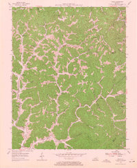
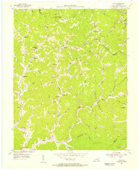
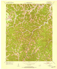
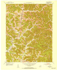
1954 Map of Scalf
USGS Topo · Published 1971About this map
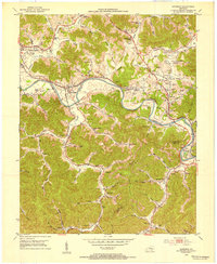
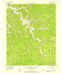
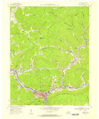
Stinking Creek and its many winding tributaries define the settlement patterns of this mountain landscape in the early 1950s. Communities like Salt Gum, Scalf, and Hammond are linked by a network of unimproved roads following the narrow valley floors between high ridges like Kentucky Ridge. The map reveals a dense social infrastructure for a rural area, marked by numerous small schools such as Macroe School and Bargo School, alongside spiritual centers like Salt Gum Church. This distribution of landmarks along Hubbards Fork and Mills Creek suggests a population deeply integrated with the topography, where each branch and gap supported a distinct local identity. The border between Clay and Knox counties runs along the high ground, while the southern reaches of the map near Dewitt transition toward the coal-rich boundaries of Bell County.
Find a feature on this map
60 named features on this map. Tap any name to fly to it.
Don’t see what you’re looking for? This feature index may not catch every label — zoom into the map to look around manually.
Map Details
Editions of this 1954 Scalf Map
2 editions found
Other maps of this area

1886 · Cumberland Gap
USGS Topo · 1:125,000

1888 · Cumberland Gap
USGS Topo · 1:125,000

1891 · Manchester
USGS Topo · 1:125,000

1891 · Cumberland Gap
USGS Topo · 1:125,000

1903 · Pineville
USGS Topo · 1:48,000
1952 · Hima
USGS Topo · 1:24,000
1952 · Fount
USGS Topo · 1:24,000
1952 · Artemus
USGS Topo · 1:24,000
1954 · Ogle
USGS Topo · 1:24,000
1954 · Pineville
USGS Topo · 1:24,000