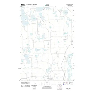
2010 Map of Scandia
USGS Topo · Published 2010About this map
Scandia serves as the primary settlement hub in this lake-rich region of eastern Minnesota, anchoring a landscape defined by its glacial hydrology. The community is centered around the Scandia Post Office and Johnson Memorial Park, providing a window into the local geography of the early 21st century. The map reveals a dense concentration of water bodies, from the larger Chisago Lake and Bone Lake to smaller basins like Spider Lake and Ice Lake.
Find a feature on this map
83 named features on this map. Tap any name to fly to it.
Don’t see what you’re looking for? This feature index may not catch every label — zoom into the map to look around manually.
Map Details
Editions of this 2010 Scandia Map
This is the sole edition of this map. No revisions or reprints were ever made.
Other maps of this area

1900 · St Croix Dalles
USGS Topo · 1:62,500

1901 · St Croix Dalles
USGS Topo · 1:62,500

1948 · New Richmond
USGS Topo · 1:62,500

1948 · Stillwater
USGS Topo · 1:62,500

1949 · New Richmond
USGS Topo · 1:62,500

1949 · Stillwater
USGS Topo · 1:62,500

1953 · Stillwater
USGS Topo · 1:250,000

1954 · Hugo
USGS Topo · 1:24,000

1955 · St. Croix Dalles
USGS Topo · 1:62,500

1955 · Marine
USGS Topo · 1:24,000