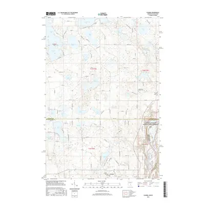
2016 Map of Scandia
USGS Topo · Published 2016About this map
The St Croix River defines the eastern boundary of this 2016 survey, carving a deep valley through the glaciated landscape where the Lower Saint Croix National Scenic Riverway protects the shoreline. To the west, the terrain is dominated by a dense network of post-glacial lakes and wetlands, ranging from the large Chisago Lake and S Center Lake in the north to the smaller Sea Lake and Bone Lake further south. The settlement of Scandia serves as a central hub, surrounded by a rural grid that preserves numerous historic sites.
Find a feature on this map
127 named features on this map. Tap any name to fly to it.
Don’t see what you’re looking for? This feature index may not catch every label — zoom into the map to look around manually.
Map Details
Editions of this 2016 Scandia Map
This is the sole edition of this map. No revisions or reprints were ever made.
Other maps of this area

1900 · St Croix Dalles
USGS Topo · 1:62,500

1901 · St Croix Dalles
USGS Topo · 1:62,500

1948 · New Richmond
USGS Topo · 1:62,500

1948 · Stillwater
USGS Topo · 1:62,500

1949 · New Richmond
USGS Topo · 1:62,500

1949 · Stillwater
USGS Topo · 1:62,500

1953 · Stillwater
USGS Topo · 1:250,000

1954 · Hugo
USGS Topo · 1:24,000

1955 · St. Croix Dalles
USGS Topo · 1:62,500

1955 · Marine
USGS Topo · 1:24,000