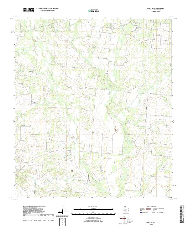
2022 Map of Schattel NW
USGS Topo · Published 2022About this map
San Miguel Cr and its various tributaries define the drainage patterns of this rural landscape in Frio County. The terrain is marked by distinctive depressions such as Mustang Hollow and Sand Hollow, which likely influence the local movement of water toward the larger creek systems like Black Cr and Buckhorn Cr. For those tracing local heritage, the Sand Hollow Cem stands as a significant landmark, situated near the intersection of Co RD 2000 and Smith Rd. A network of rural routes, including FM 2779, E FM 140, and various named county roads like Biediger Rd and Sadler Rd, provide a framework for the ranches and homesteads that populate this south Texas region. The absence of a centralized town center emphasizes the pastoral, low-density nature of the area.
Find a feature on this map
32 named features on this map. Tap any name to fly to it.
Don’t see what you’re looking for? This feature index may not catch every label — zoom into the map to look around manually.
Map Details
Editions of this 2022 Schattel NW Map
This is the sole edition of this map. No revisions or reprints were ever made.
Other maps of this area

1927 · Pearsall
USGS Topo · 1:62,500

1934 · Schattel
USGS Topo · 1:62,500

1942 · Natalia
USGS Topo · 1:62,500

1953 · Crystal City
USGS Topo · 1:250,000

1954 · San Antonio
USGS Topo · 1:250,000

1955 · Crystal City
USGS Topo · 1:250,000

1957 · San Antonio
USGS Topo · 1:250,000

1961 · Crystal City
USGS Topo · 1:250,000

1964 · Pearsall South
USGS Topo · 1:24,000

1964 · Ghost Hill
USGS Topo · 1:24,000