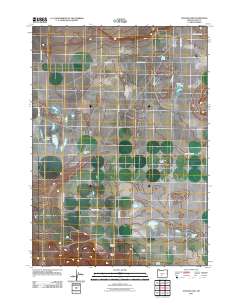
2011 Map of Schaub Lake
USGS Topo · Published 2011About this map
Fort Rock Valley defines the character of this landscape in Lake County, where scattered homesteads and water bodies dot the high desert floor. The settlement pattern is marked by family-named ranching operations, such as Morehouse Ranch and Boley Ranch, which are connected by a grid of county roads including Fort Rock Rd and County Rd-5-10. The presence of ephemeral and named water sources like Schaub Lake, Windmill Lake, and Dog Lake highlights the vital role of water management in this arid ranching country.
Find a feature on this map
23 named features on this map. Tap any name to fly to it.
Don’t see what you’re looking for? This feature index may not catch every label — zoom into the map to look around manually.
Map Details
Editions of this 2011 Schaub Lake Map
This is the sole edition of this map. No revisions or reprints were ever made.
Other maps of this area

1955 · Crescent
USGS Topo · 1:250,000

1957 · Crescent
USGS Topo · 1:250,000

1958 · Crescent
USGS Topo · 1:250,000

1968 · Silver Lake
USGS Topo · 1:24,000

1970 · Crescent
USGS Topo · 1:250,000

1979 · Crescent
USGS Topo · 1:100,000

1981 · Hogback Butte
USGS Topo · 1:24,000

1981 · Cougar Mtn
USGS Topo · 1:24,000

1981 · Thorn Lake
USGS Topo · 1:24,000

1981 · Lane Lake
USGS Topo · 1:24,000