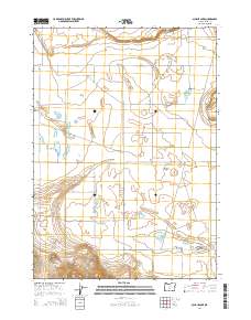
2014 Map of Schaub Lake
USGS Topo · Published 2014About this map
Fort Rock Valley dominates this high-desert landscape in northern Lake County, where the topography is defined by ephemeral lakebeds and volcanic formations. The presence of Schaub Lake, Dog Lake, and Cream Lake suggests a basin-and-range hydrology where water collection is seasonal and vital. To the south, the terrain rises into the Connley Hills, which are accessed through the Morning Gap. This era of the landscape is navigated by a network of rural routes such as Plainview Rd and the Christmas Valley Back Country Bywy. The map reveals a highly structured grid of section lines and range boundaries, including t26s r15e, illustrating the systematic division of Oregon's interior for ranching and public land management. Named landmarks like Flatiron and Poplars serve as distinct navigational points within the expansive valley floor.
Find a feature on this map
27 named features on this map. Tap any name to fly to it.
Don’t see what you’re looking for? This feature index may not catch every label — zoom into the map to look around manually.
Map Details
Editions of this 2014 Schaub Lake Map
This is the sole edition of this map. No revisions or reprints were ever made.
Other maps of this area

1955 · Crescent
USGS Topo · 1:250,000

1957 · Crescent
USGS Topo · 1:250,000

1958 · Crescent
USGS Topo · 1:250,000

1968 · Silver Lake
USGS Topo · 1:24,000

1970 · Crescent
USGS Topo · 1:250,000

1979 · Crescent
USGS Topo · 1:100,000

1981 · Hogback Butte
USGS Topo · 1:24,000

1981 · Cougar Mtn
USGS Topo · 1:24,000

1981 · Thorn Lake
USGS Topo · 1:24,000

1981 · Lane Lake
USGS Topo · 1:24,000