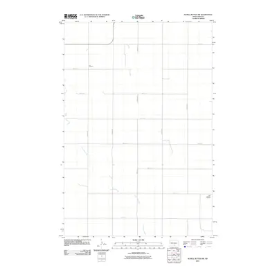
2011 Map of Schell Buttes NW
USGS Topo · Published 2011About this map
Long Lake Creek meanders through this agricultural landscape in Emmons County, defining the drainage patterns across a grid of section roads and farm lanes. The area is characterized by its rural settlement history, anchored by the Tell Cemetery in the northwest and Saint Boniface Cemetery in the southeast. These sites serve as primary genealogical landmarks for the region, marking the community centers of early 20th-century townships. The map illustrates a strictly ordered township-and-range system, where roads like 23rd Ave SE and 70th St SE facilitate the transport of goods and access to isolated homesteads. This 2011 survey captures the enduring rural character of North Dakota's central plains, where small cemeteries and creek beds remain the most significant landmarks on the horizon.
Find a feature on this map
17 named features on this map. Tap any name to fly to it.
Don’t see what you’re looking for? This feature index may not catch every label — zoom into the map to look around manually.
Map Details
Editions of this 2011 Schell Buttes NW Map
This is the sole edition of this map. No revisions or reprints were ever made.
Other maps of this area

1953 · Jamestown
USGS Topo · 1:250,000

1954 · Bismarck
USGS Topo · 1:250,000

1956 · Jamestown
USGS Topo · 1:250,000

1958 · Bismarck
USGS Topo · 1:250,000

1975 · Linton NE
USGS Topo · 1:24,000

1975 · Braddock
USGS Topo · 1:24,000

1975 · Kintyre
USGS Topo · 1:24,000

1979 · Schell Buttes
USGS Topo · 1:24,000

1979 · Bismarck
USGS Topo · 1:100,000

1979 · Schell Buttes SW
USGS Topo · 1:24,000