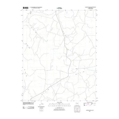
2010 Map of Schmitz Ranch
USGS Topo · Published 2010About this map
Schmitz Ranch and the outlier Ojito Camp define the human footprint in this arid landscape of Rio Arriba County. The terrain is deeply sculpted by drainage systems such as Cañon de los Ojitos and Wild Horse Canyon, which cut through the high elevations of Wild Horse Mesa. This early 21st-century survey reflects a remote ranching environment where movement is dictated by the rugged geography of the San Juan Basin. Secondary routes like Co Road 405 and Co Road 529 provide the only significant access through the breaks and mesas. The drainage patterns of Tapicito Creek and Bull Well Canyon illustrate the complex hydrology of the high desert, where seasonal water flow has historically influenced the location of camps and livestock operations.
Find a feature on this map
10 named features on this map. Tap any name to fly to it.
Don’t see what you’re looking for? This feature index may not catch every label — zoom into the map to look around manually.
Map Details
Editions of this 2010 Schmitz Ranch Map
This is the sole edition of this map. No revisions or reprints were ever made.
Other maps of this area

1889 · Largo
USGS Topo · 1:250,000

1895 · Largo
USGS Topo · 1:250,000

1954 · Aztec
USGS Topo · 1:250,000

1958 · Aztec
USGS Topo · 1:250,000

1962 · Aztec
USGS Topo · 1:250,000

1963 · Lapis Point
USGS Topo · 1:24,000

1963 · Schmitz Ranch
USGS Topo · 1:24,000

1963 · Otero Store
USGS Topo · 1:24,000

1963 · Lindrith
USGS Topo · 1:24,000
1963 · Ojito
USGS Topo · 1:24,000