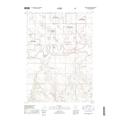
2017 Map of School Section Butte
USGS Topo · Published 2017About this map
The White River winds through this section of Jackson County, carving a complex riparian corridor through the protected reaches of the Buffalo Gap National Grassland. The landscape is dominated by significant elevation markers, most notably School Section Butte and the prominent Flat Top Butte to the northwest. These landforms rise above a network of drainages including Bear-in-the-Lodge Cr, Eagle Nest Cr, and Sixteenmile Cr, which define the local hydrology. This 2017 survey captures a largely undeveloped terrain where Bureau of Indian Affairs and county roads, such as White River Rd and Co Rd Ch 6, provide the primary access through the vast grassland. The map reveals the intricate township and range boundaries that organize this part of the northern Great Plains, illustrating how the physical geography of the river valley dictates the placement of transit routes like BIA Rd.
Find a feature on this map
25 named features on this map. Tap any name to fly to it.
Don’t see what you’re looking for? This feature index may not catch every label — zoom into the map to look around manually.
Map Details
Editions of this 2017 School Section Butte Map
This is the sole edition of this map. No revisions or reprints were ever made.
Other maps of this area

1950 · Interior
USGS Topo · 1:24,000

1950 · Interior SE
USGS Topo · 1:24,000

1950 · Potato Creek
USGS Topo · 1:24,000

1950 · Wanblee
USGS Topo · 1:24,000

1950 · Weta
USGS Topo · 1:24,000

1951 · Wanblee NW
USGS Topo · 1:24,000

1951 · School Section Butte
USGS Topo · 1:24,000

1955 · Martin
USGS Topo · 1:250,000

1958 · Martin
USGS Topo · 1:250,000

1960 · Cottonwood SW
USGS Topo · 1:24,000